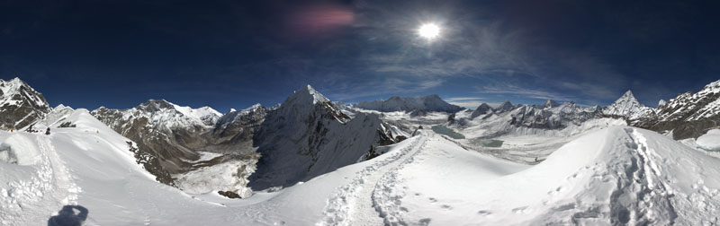
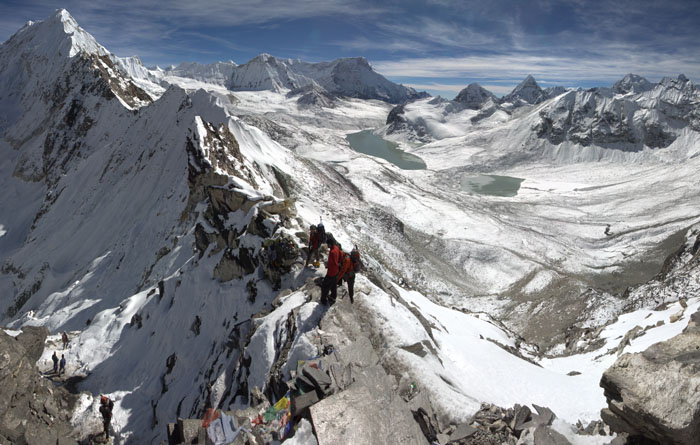
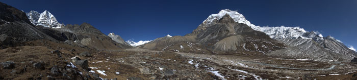
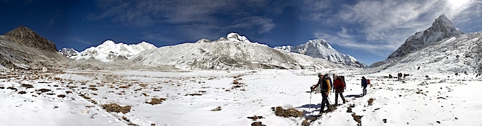
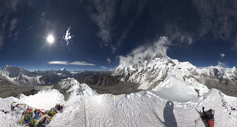
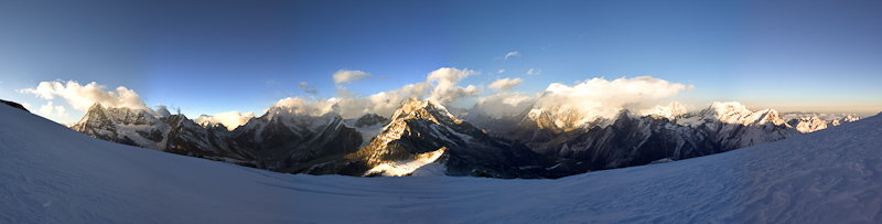
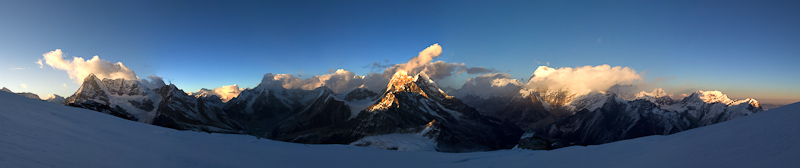
Mountain panorama from the top of Amphulapcha pass (5845 m). One can see the holy lakes of Panch Pokhari below. Also Chamlang (7321 m), Hunku (6119 m), Peak 41 (6648 m), Mera Peak (6476 m), Malangphulang (6573 m), the top of Ama Dablam (6814 m), Nuptse (7864 m), Everest (8848 m), Lhotse (8516 m), Lhotse Shar (8382 m), and Imja Tse/Island Peak (6189 m) in front of the Lhotse south face. Rappelling the north side of Amphulapcha pass (5845 m). We came from the south side passing by the holy lakes of Panch Pokhari below. One can see: Chamlang (7321 m), Hunku (6119 m), Peak 41 (6648 m), Mera Peak (6476 m), and Malangphulang (6573 m). Mountain panorama shot in the Honggu Khola valley near lake Panch Pokhari at around 5400 m. One can see: Amphulapcha pass (5845 m), Nuptse (7864 m), Lhotse (8516 m), Lhotse Shar (8382 m), Baruntse (7168 m), and Chamlang (7321 m).Mountain panorama at around 4900 m near Kongme Dingma just before dropping into the Honggu Khola valley. One can see: Naulekh (6368 m), Mera Peak (6476 m), Peak 41 (6648 m), Baruntse (7168 m), and Chamlang (7321 m).Mountain panorama from the Honggu Khola valley. One can see: Peak 41 (6648 m), Everest (8848 m), Lhotse (8516 m), Lhotse Shar (8382 m), and Chamlang (7321 m).Mountain panorama from the Honggu Khola valley after light snowfall overnight. Visible are Everest (8848 m), Lhotse (8516 m), Lhotse Shar (8382 m), Baruntse (7168 m), and Chamlang (7321 m).Mountain panorama from the summit of Imja Tse/Island Peak (6189 m) in front of the mighty 2000 m high Lhotse south face. One can see numerous mountains, among them: Makalu (8481 m), Peak 41 (6648 m), Amphulapcha pass (5845 m), Mera Peak (6476 m), Kangtega (6779 m), Numbur (6959 m), Ama Dablam (6814 m), Tabuche Peak (6495 m), Cholatse (6335 m), Arakam Tse (6423 m), Chhukhung Ri (5550 m), Cho Oyo (8201 m, hidden in the clouds), Nuptse (7864 m, hidden in the clouds), Lhotse (8516 m), and Lhotse Shar (8382 m). (source: http://www.himalaya-info.org/island_peak.htm)Mountain panorama near Khare (4900 m)in the late afternoon. After arriving in Khare we did an acclimatization hike to the top of a nearby ridge (5210 m) from which the panorama was shot. One can see: Mera Peak (6476 m), Kyashar/Tangtse (6770 m), and Malangphulang (6573 m).
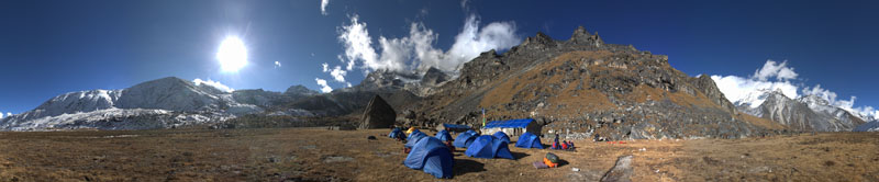
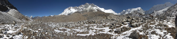
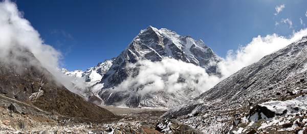
Camp at Kongme Dingma (4800 m)Mountain panorama shot from a moraine near Amphulapcha Glacier at around 5200 m. One can see: Tabuche Peak (6495 m), Cholatse (6335 m), Arakam Tse (6423 m), Nuptse (7864 m), Lhotse (8516 m), Lhotse Shar (8382 m), and Imja Tse/Island Peak (6189 m) in front of the Lhotse south face.Mountain panorama shot near our camp site by lake Amphulapcha Tsho at around 5000 m. One can see: Tabuche Peak (6495 m), Cholatse (6335 m), Arakam Tse (6423 m), Nuptse (7864 m), Lhotse (8516 m), Lhotse Shar (8382 m), and Imja Tse/Island Peak (6189 m) in front of the Lhotse south face.Mountain panorama shot from the top of a moraine between Chhukhung and lake Imja Tsho. One can see: Tabuche Peak (6495 m), Cholatse (6335 m), Arakam Tse (6423 m), Chhukhung Ri (5550 m), Nuptse (7864 m), Lhotse (8516 m), Lhotse Shar (8382 m), Imja Tse/Island Peak (6189 m) in front of the Lhotse south face, and Ama Dablam (6814 m).Mountain panorama near Mera La pass (5400 m). One can see: Mera Peak (6476 m), Kusum Khangkaru (6370 m), and Kyashar/Tangtse (6770 m).The Northwest face of Mera Peak (6476 m) seen from a point (about 4500 m) high above Tangnag in the Inkhu Khola valley. Mera La pass is to the left of the peak.Panoramas from the north side of Mera Peak (6476 m) just before sunset. I summited late, about 16:30, and it was quickly getting dark as I descended. One can see: Peak 41 (6641 m) in the center, lit by the sun. Then Everest (8848 m), Lhotse (8516 m), Lhotse Shar (8382 m) peaking through the clouds. Also Makalu (8462 m) (partially in the clouds), and Chamlang (7321 m). (source: http://www.himalaya-info.org/mera_peak.htm)Panoramas from the north side of Mera Peak (6476 m) just before sunset. I summited late, about 16:30, and it was quickly getting dark as I descended. One can see: Peak 41 (6641 m) in the center, lit by the sun. Then Everest (8848 m), Lhotse (8516 m), Lhotse Shar (8382 m) peaking through the clouds. Also Makalu (8462 m) (partially in the clouds), and Chamlang (7321 m). (source: http://www.himalaya-info.org/mera_peak.htm)Mountain panorama from the summit of Mera Peak (6476 m) just before sunset. This was shot on Mera Central summit. Mera North summit is visible nearby. It is only about 15 m higher but since there is a bergschrund to cross I didn't want to do it by myself. One can see: Peak 41 (6641 m), Everest (8848 m) above the clouds, and Lhotse (8516 m). Also Makalu (8462 m) (above the clouds), and Chamlang (7321 m). (source: http://www.himalaya-info.org/mera_peak.htm)
Peru 2012
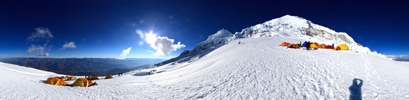
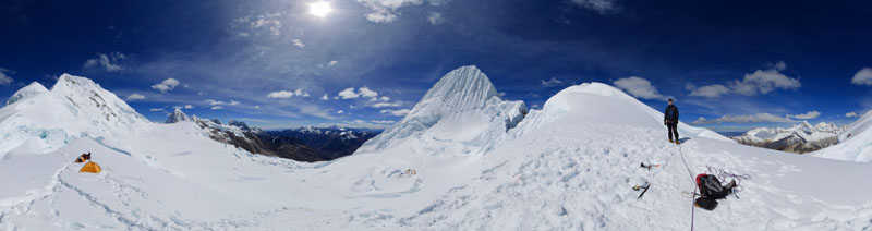
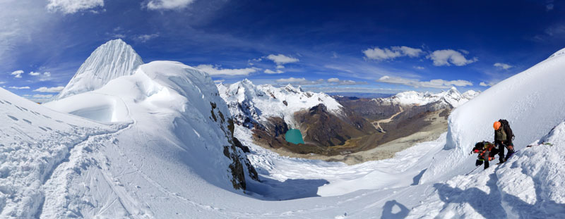
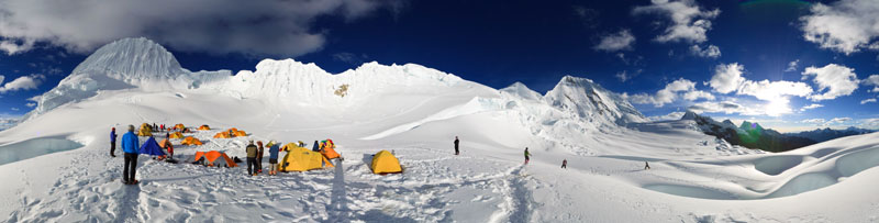
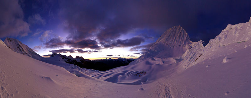
After setting up camp at Alpamayo's northern base camp we practiced jumaring and rappelling for the upcoming climb of Alpamayo (5947 m).Alpamayo's northern base camp is beautifully located at an elevation of 4533 m with great views of the surrounding peaks like Santa Cruz (6241 m).View from the small pass between Alpamayo (5947 m) and Quitaraju (6036 m) where the southern approach route joins. Below Alpamayo is the high camp site.Climbers rappelling on their way down the mountain at the small pass between Alpamayo (5947 m) and Quitaraju (6036 m) where the southern approach route joins.Alpamayo's high camp just before sunset with Alpamayo (5947 m) and Quitaraju (6036 m) dominating the skyline.Blue hour with Alpamayo (5947 m) and Alpamayo's high camp.This panorama was taken on a small pass just before we dropped down toward the glacier and Alpamayo's northern moraine camp. The pyramidal peak is Alpamayo (5947 m), the peaks just to the left are Jankarurish (5601 m), and Tayapampa (5675 m).Panorama with Tayapampa (5675 m), Jankarurish (5601 m), and Alpamayo (5947 m) (hidden in the clouds). This was taken just before reaching Alpamayo's northern moraine camp.Panorama taken at Alpamayo's northern moraine camp with Tayapampa (5675 m), Jankarurish (5601 m), and Alpamayo (5947 m).
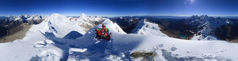
Beautiful sunset at Alpamayo's northern moraine camp with Tayapampa (5675 m), Jankarurish (5601 m), and Alpamayo (5947 m).The sun sets quickly in Peru. Last light at Alpamayo's northern moraine camp with Tayapampa (5675 m), Jankarurish (5601 m), and Alpamayo (5947 m).Alpamayo (5947 m) summit panorama. After getting up at 3:30am and climbing the 500m high French Direct route (all the while being peppered with ice chunks set off by climbers above) everybody reached the summit. After summit celebrations a looong rappel brought us back down to high camp for a well deserved rest.
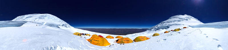
Huascaran's first high camp just before sunset with Huascaran (6768 m).Huascaran's second high camp is located just below 6000 m on the pass between Huascaran Norte (6664 m) and Huascaran Sur (6768 m).
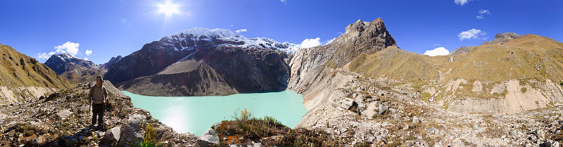
Hiker on top of a high moraine with Lake Jancarurish and Tayapampa (5675 m) before reaching Alpamayo's northern base camp.Vallunaraju (5780 m) summit panorama with Roger looking down.
/pano-AmphulapchaBC(S).thumbnail.jpg)






1/pano-AlpamayoBC(N)1.800.jpg)
2/pano-AlpamayoBC(N)2.800.jpg)
1/pano-AlpamayoMC(N)1.800.jpg)
3/pano-AlpamayoMC(N)3.800.jpg)
4/pano-AlpamayoMC(N)4.800.jpg)
5/pano-AlpamayoMC(N)5.800.jpg)
6/pano-AlpamayoMC(N)6.800.jpg)